


HPLHS Prop Documents Collection
The HPLHS has always believed that excellent props greatly enhance the fun and immersion of role-playing games. We are developing a series of high-quality prop documents that can be generally useful to Call of Cthulhu gamers, and collectible in their own right. "Gamable and Framable" is our motto.
This page is for owners of the HPLHS Prop Documents Collection prop packs to tell you more about the items in your collection. Here you’ll find source material, inspirations, and other factoids that we hope will deepen your enjoyment of these prop collections, and tips for Keepers and players to get the most use out of them.
Get it now!Prop Pack Contents
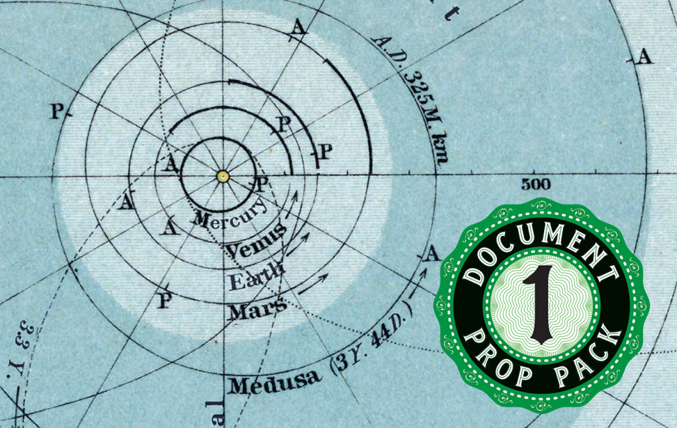
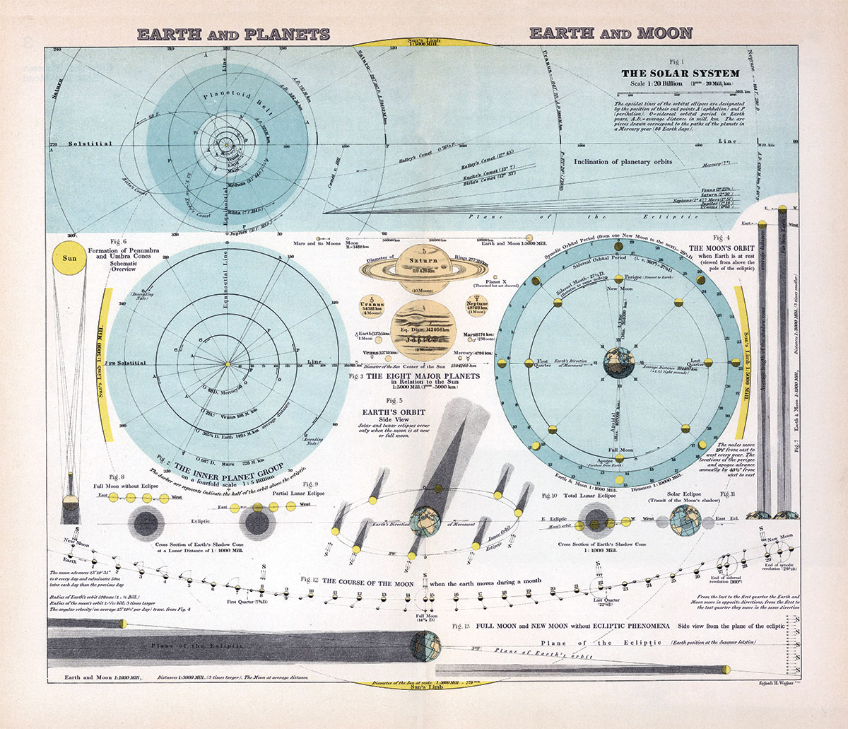 This map is based on a German map which appeared in Sydow-Wagner's Methodical School Atlas circa 1940. It has been painstakingly translated and re-typeset into English, with the help of HPLHS Member Felix Salinger. It features thirteen informative celestial charts, showing the solar system and the relative position of earth and planets and earth and moon. The original map did not include Pluto, but we have added the theoretical "Planet X", which might be the home of intelligent fungoid creatures with sinister plans for our own planet....
21 x 18 inches.
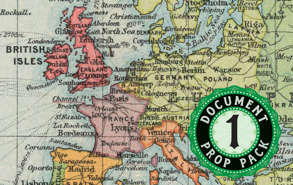
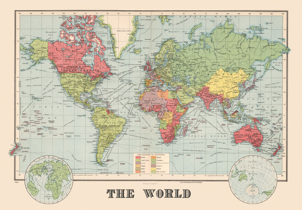 This prop map was first developed as a bonus item for our Masks of Nyarlathotep Gamer Prop Set. Based on real vintage maps from 1923, it has been edited to include a couple of locations from that game which did not appear on the original map. In addition to countries and major world cities it shows ocean shipping routes in use at the time. Useful for planning your next global adventure!
26 x 18 inches.
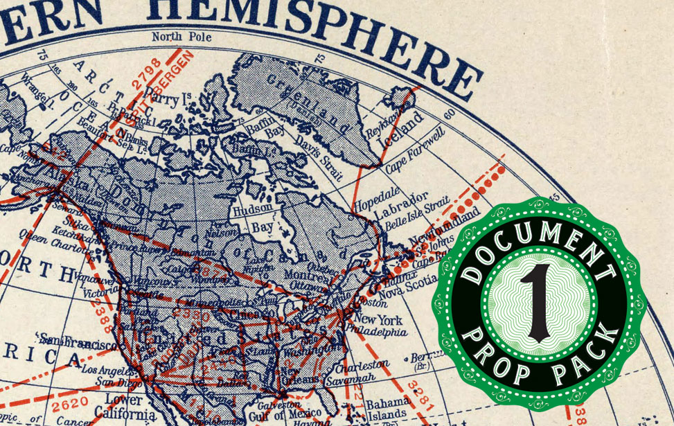
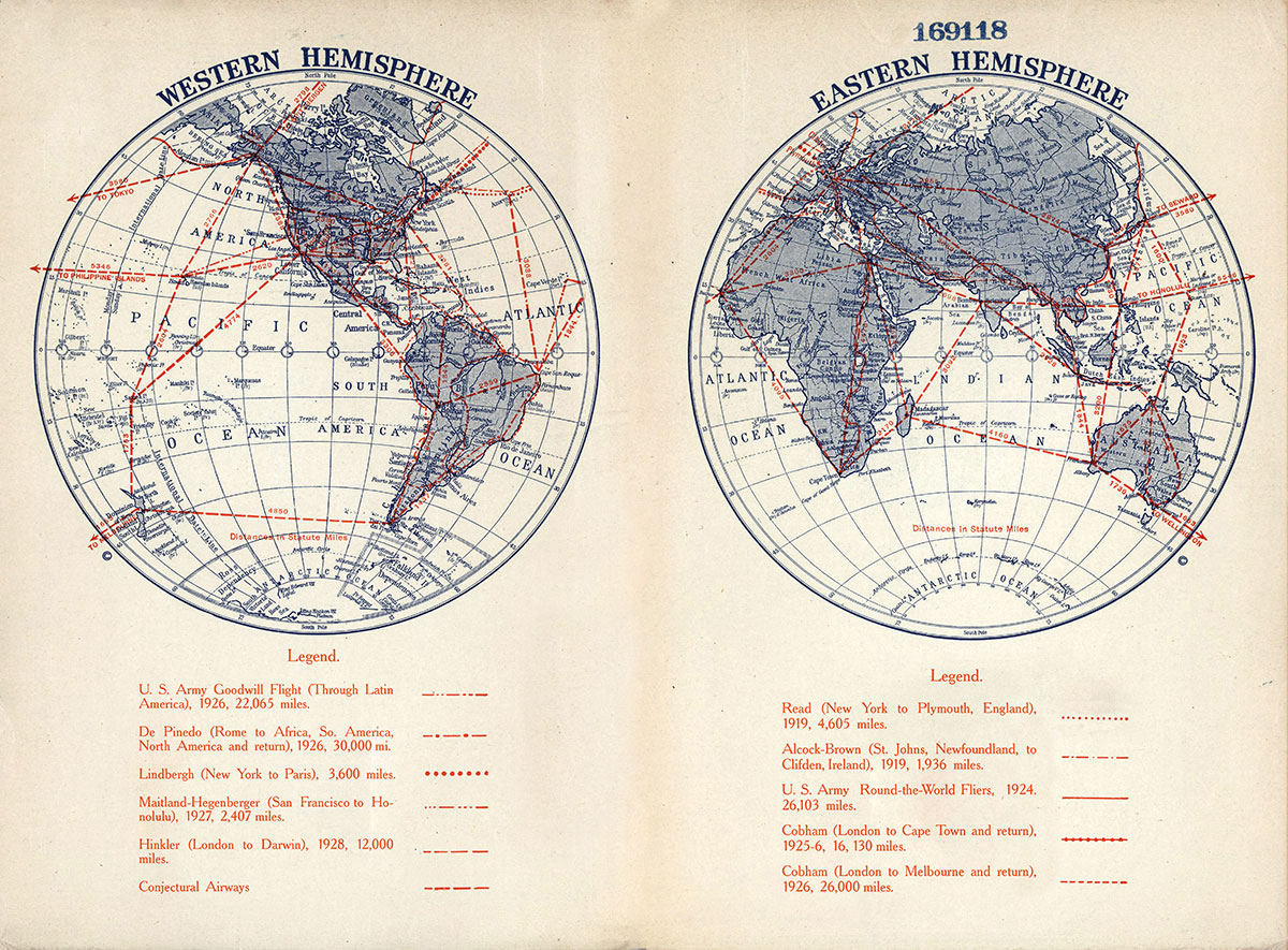 This map is based on one found in the library of U.C. Berkeley, showing long-distance airplane flights that had been undertaken up to 1928. It has been digitally cleaned up and restored.
15 x 11 inches.
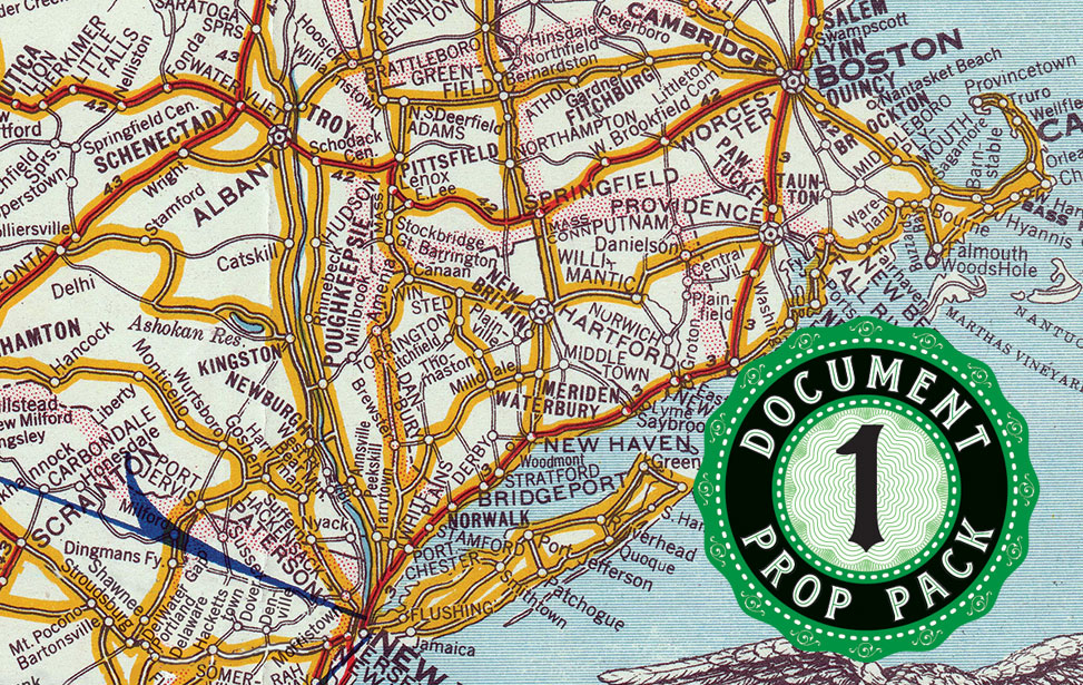
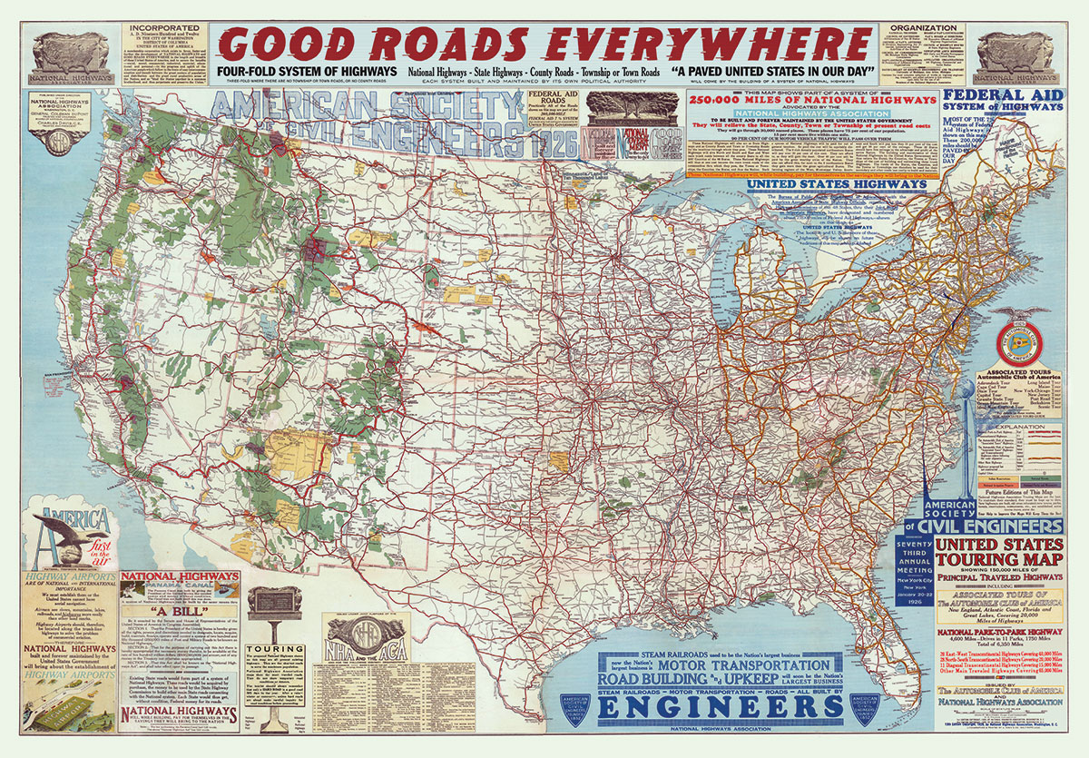 This map is based on one issued in 1926 by the National Highways Association, to advocate for the paving of roads nationwide and the construction of new highways. It just slightly predates the establishment of the famous Route 66. In the mid-1920s, as personal automobile ownership was still relatively new, many roads in America were still not paved, and investigators driving from one city to another might have to deal with some rough conditions.
The "Good Roads Everywhere" movement began with Charles Henry Davis, a civil engineer and wealthy businessman based in South Yarmouth, Massachusetts. Davis was president of the American Road Machine Company. His grandfather, Edward Morris Davis of Philadelphia, and father, Henry Corbit Davis, had been involved in road construction commercially. Davis' many accomplishments included construction of the first high-speed street railway from Washington, D.C., to Mount Vernon, President George Washington's home in Virginia.
In 1911, Davis established the National Highways Association, which was incorporated in the District of Columbia in early 1912. Slogan: GOOD ROADS EVERYWHERE. One of its earliest initiatives was publication of a map a 50,000-mile National Highways network, which he described as "a broad and comprehensive system of National Highways, built, owned, and maintained by the National Government." The map was touted as very accurate and frequently updated.
This version has been painstakingly restored from a high-resolution scan of a rather tattered copy. A few real towns have been replaced with fictional ones.
34.25 x 23.75 inches.
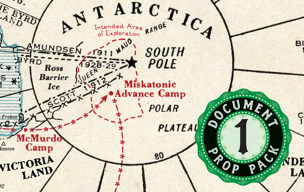
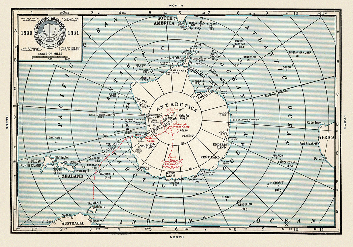 This map is based on one from the 1930s by J. Thomas Co. It has been augmented to show the route of the Miskatonic University Antarctic Expedition, but also features other expeditions made to Antarctica up to that time. It would seem this map was produced just before tragedy struck the expedition....
16 x 11 inches.
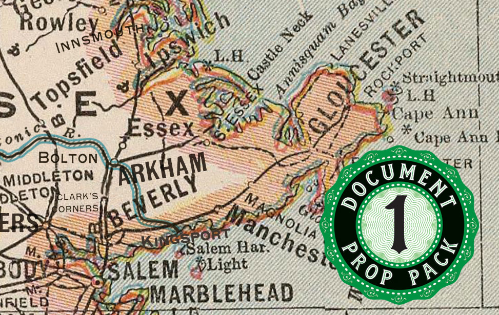
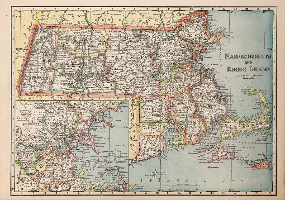
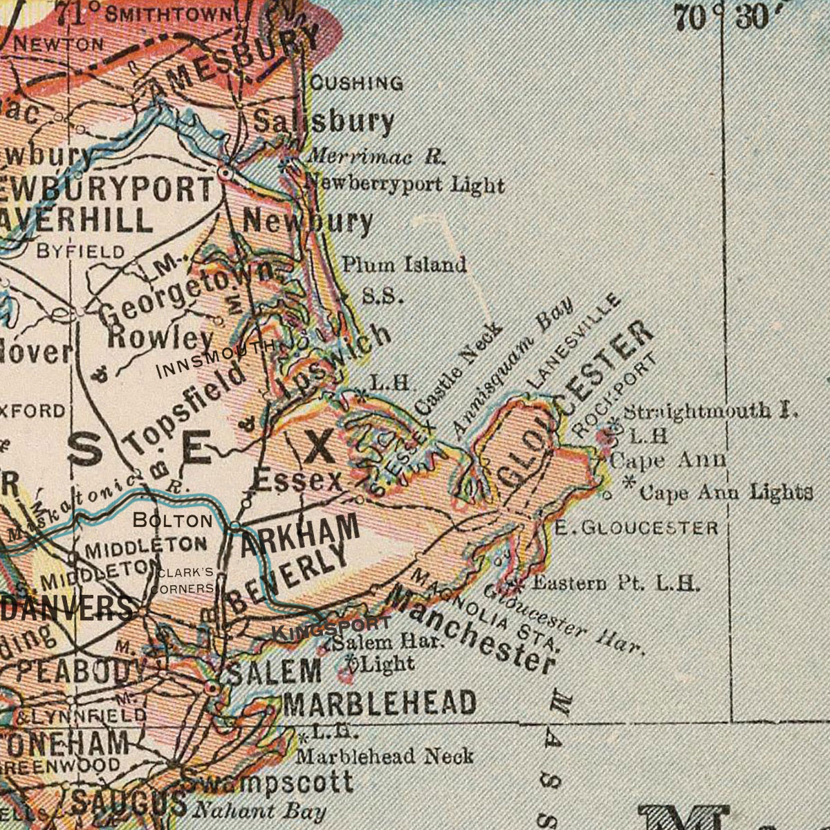 This map is based on one appearing in the Official Paved Road and Commercial Survey of the United States published in 1927 by the National Map Company of Indianapolis. It is a highly detailed map of Massachusetts and Rhode Island, augmented with fictional locations from the works of H.P. Lovecraft. You'll find the Miskatonic River, Arkham, Bolton, Kingsport, Clark's Corners and Innsmouth as shown in the detail view here. Look for Dunwich, Dean's Corners and Aylesbury in north central Massachusetts, just south of Winchendon near C10.
25 x 18 inches.
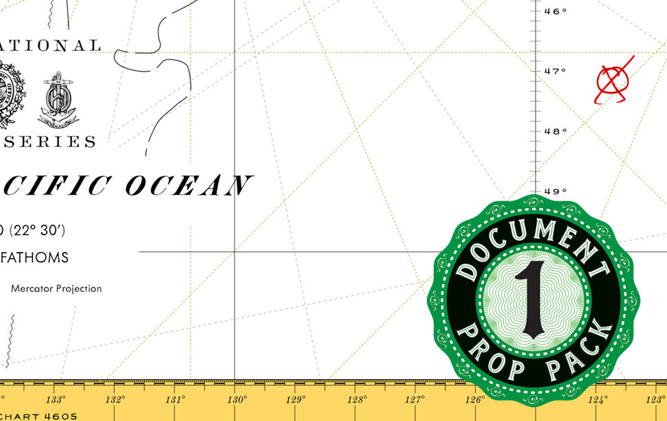
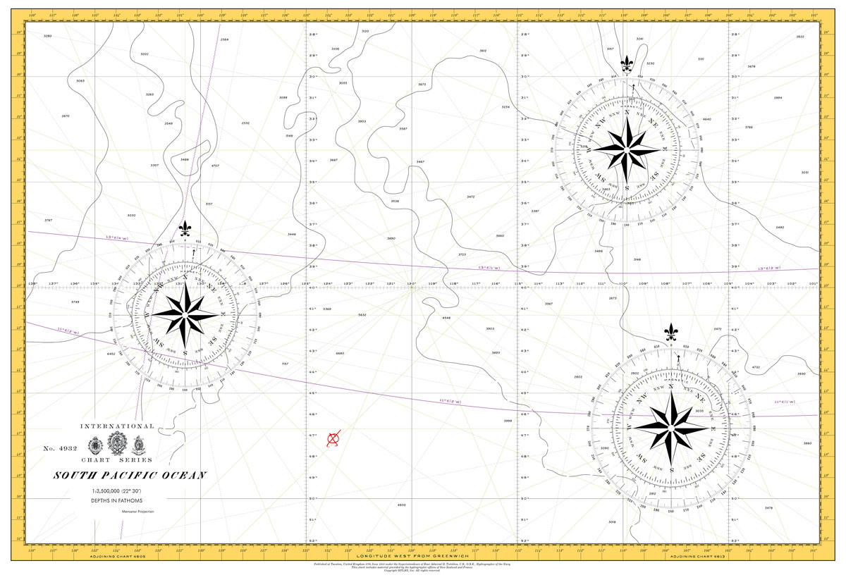 This chart was originally developed as a prop used in the HPLHS motion picture The Call of Cthulhu, and has also been included, in a larger size, as part of The Angell Box. Based on real vintage nautical charts, it shows the area of the South Pacific Ocean where the Alert encounters R'lyeh, marked with a red "X".
26 x 18 inches.
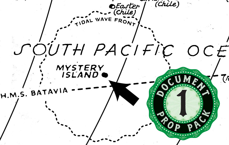
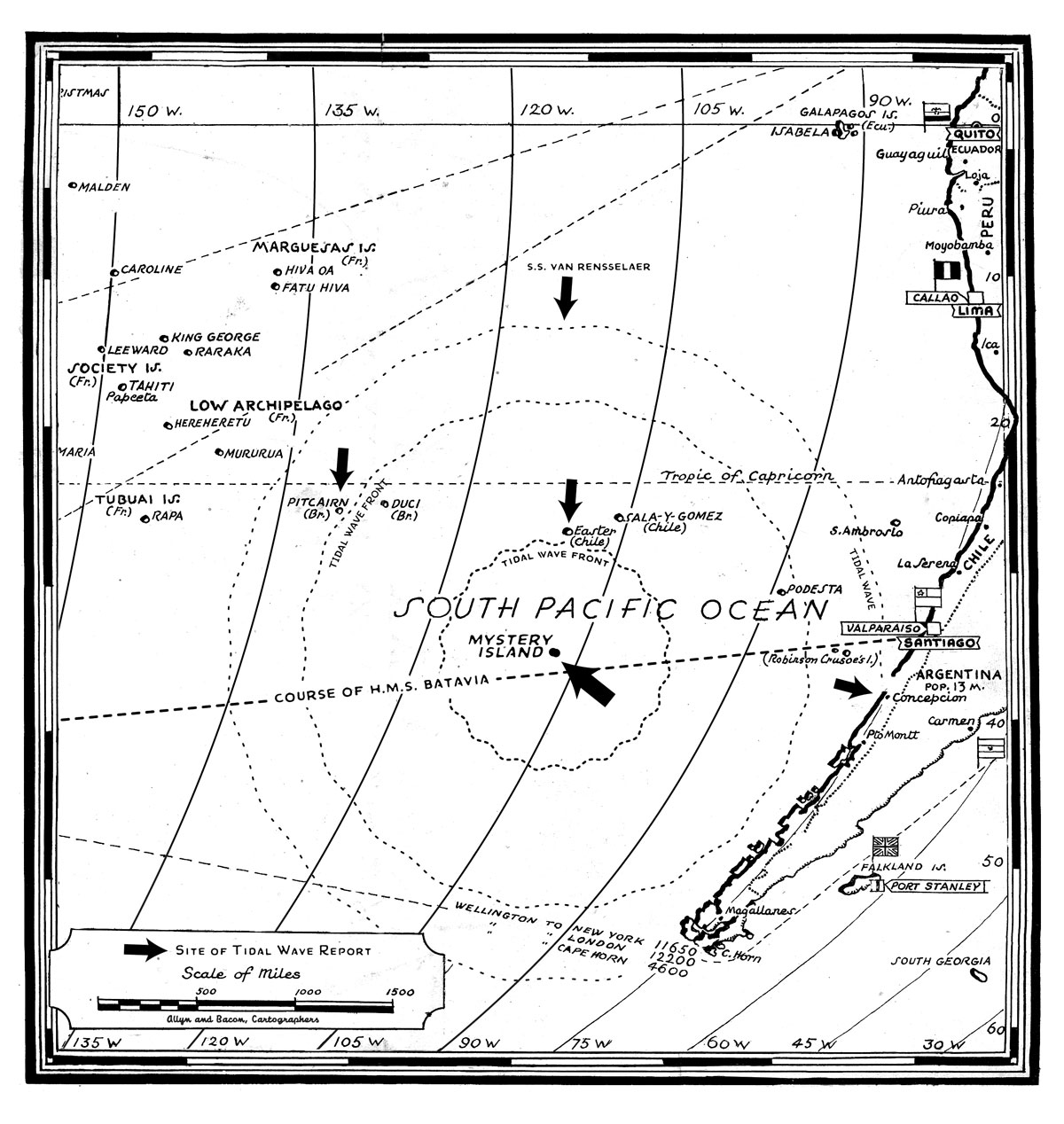 This map was originally developed for inclusion in the Dagon Newspaper. It shows the location of a mysterious uncharted island sighted by passing steamships. Although the events of Dark Adventure Radio Theatre®: Dagon occur in 1935, this map itself could be from 1925, and document the emergence of R'lyeh, or perhaps some other such phenomenon.
8.5 x 9 inches.
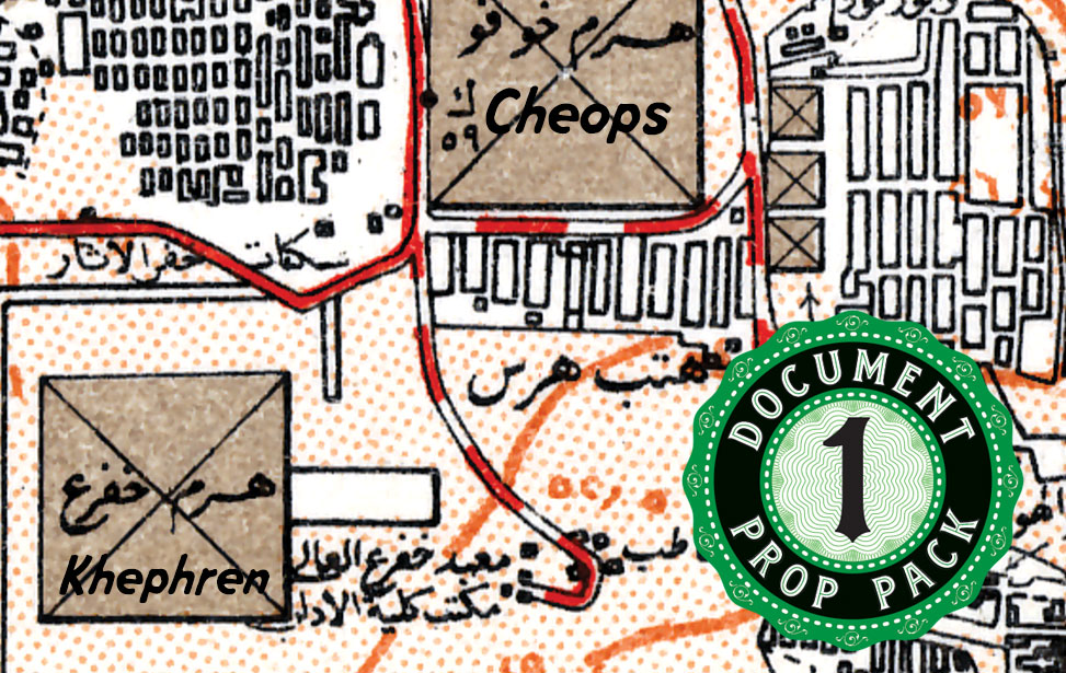
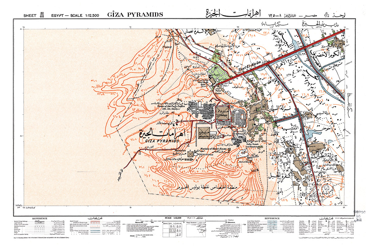 This was adapted from a map from the Library of Congress collections. It was originally developed as a prop for the Dark Adventure Radio Theatre® episode "The Brotherhood of the Beast", but this version has had all the story-specific information removed so you can use it plan your own assault on the Great Pyramids of Egypt.
24 x 16 inches.
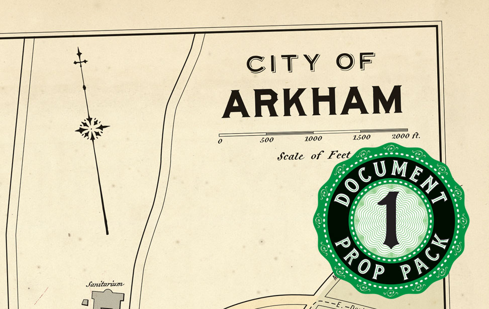
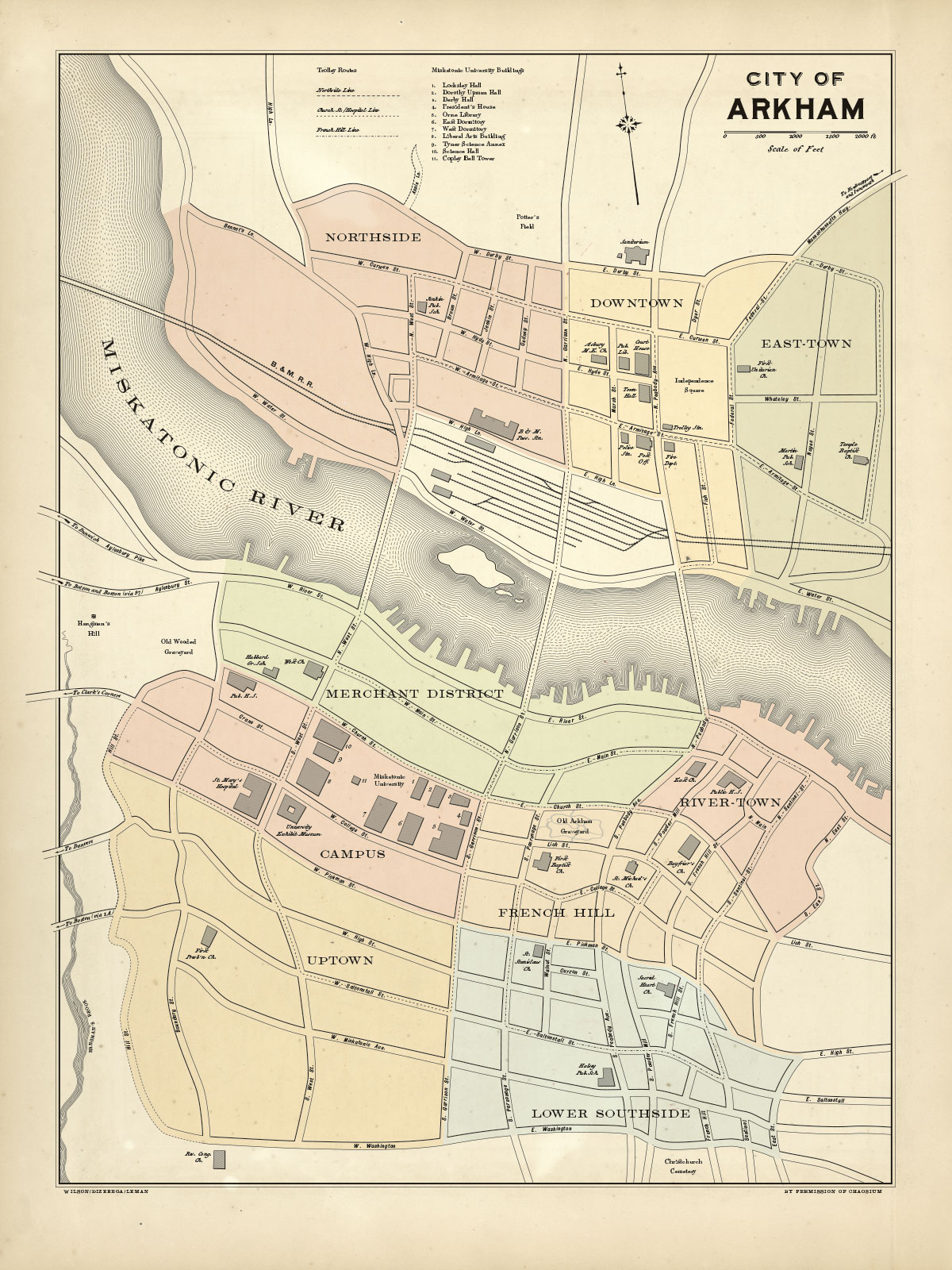 This map was originally developed for the Call of Cthulhu Classic Prop Set, and based on Chaosium's canonical map of Arkham, which is itself based on sketches made by H.P. Lovecraft himself.
18 x 26 inches
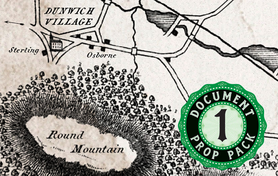
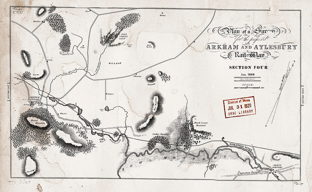 This map was originally developed as a prop for the Dark Adventure Radio Theatre® episode "The Dunwich Horror", wherein it appears at a smaller size. It is based on numerous vintage maps from the 1880s. A gigantic version of this map hangs on the wall at HPLHS world headquarters in Glendale, California.
19.5 x 12 inches.
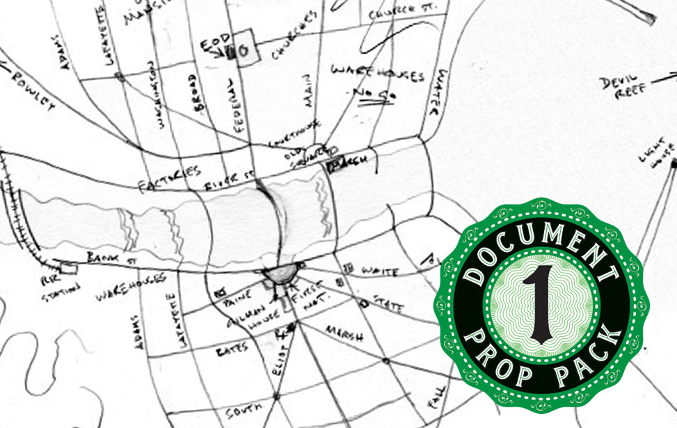
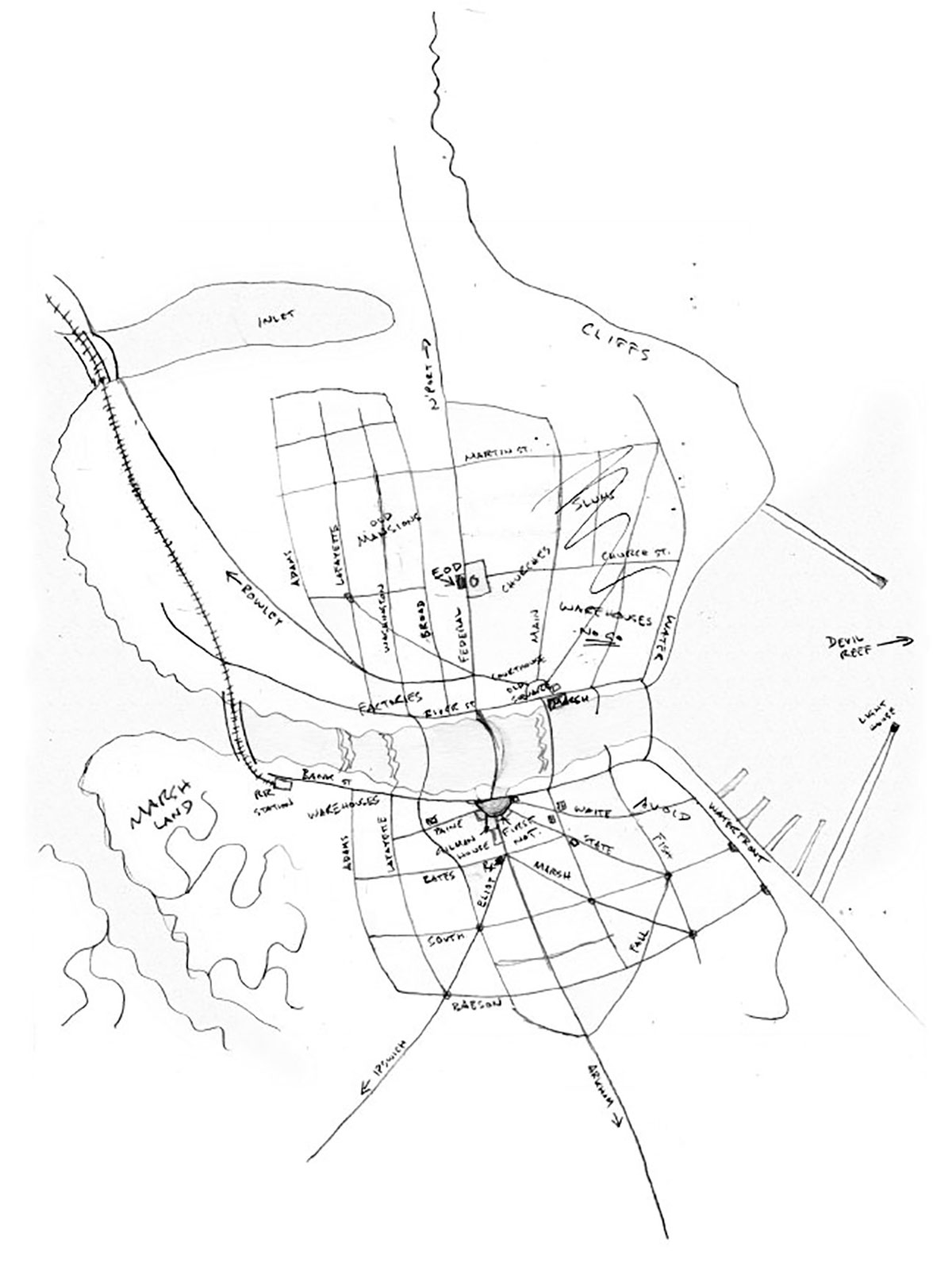 This map was originally developed as a prop for the Dark Adventure Radio Theatre® episode "The Shadow Over Innsmouth". It is an original sketch map based directly on HPL's description of the town in that story, drawn on the back of wrapping paper from the First National grocery store in Innsmouth. The stain on the front is scratch-and-sniff: it smells like fish!
9 x 12 inches.
 This large-format map was originally published in the Providence City Directory for 1921. We have restored it from the faded tissue-paper foldout of the original, and added Lovecraft's addresses as tiny stars, among other Easter Eggs.
27 x 31 inches.
 This delightful, if ethnically insensitive, map was adapted from a two-page spread that appeared in the October, 1931 issue of Popular Mechanics magazine. The same issue features a number of mind-blowing stories about underwater search and salvage, transoceanic radio transmission, an "electronic brain" and numerous other marvels and wonders. We have added some Lovecraftian detail to the map, including the logo of the Miskatonic Institute for Geographical Observation (M.I.G.O.)
18 x 12 inches.
 This map was adapted from an article in the April, 1932 issue of Popular Science Monthly magazine. We have added some specifically Lovecraftian details of geographic mystery to inspire further investigation!
18.25 x 13 inches.
 We are currently developing other exciting and convenient collections of vintage prop documents. We'll be posting more details on this page when they become available.

The H.P. Lovecraft Historical Society is an international organization for fans of the author H.P. Lovecraft. The Society produces motion pictures, audio dramas, musical projects, publications, prop replicas and much more - all of which take Lovecraft’s creations to a whole new level. Our motto is "Ludo Fore Putavimus" (We Thought It Would be Fun).
Useful Links
Contact Us
Glendale, CA 91201
U.S.A.
Phone: (747) 215-6422
Email: keeper@cthulhulives.org
1984–2026 © HPLHS; All Rights Reserved. Privacy Policy | Terms of Service